Elevation Certificates: A Builder's Guide to Timing, Cost and What Gets Measured
An elevation certificate records how high a house sits against the base flood elevation. Who signs it, when you need it and what the surveyor measures.
Last reviewed: 2026-11-05. Flood rules change and vary by jurisdiction. Confirm with your local floodplain administrator.
If your customer’s lot is in a mapped high-risk flood zone, plan on an elevation certificate. The local floodplain office decides when you need one. The customer will ask what it is, who pays for it and when it happens, so get the answers before you quote.
An elevation certificate is a form from FEMA, the Federal Emergency Management Agency, that a licensed surveyor completes, or an engineer or architect where state law allows. It records how high a building sits compared with the base flood elevation, or BFE. Communities use it to approve permits, and insurers can use it to price coverage.
Like the hub guide, this page covers one- and two-family homes in A zones away from the coast. Coastal zones and manufactured homes have their own rules.
Table of contents
- What is an elevation certificate?
- Who can complete an elevation certificate?
- When do I need an elevation certificate?
- How many surveyor visits should I plan for?
- What does a surveyor measure for an elevation certificate?
- What are highest and lowest adjacent grade?
- What does an elevation certificate cost?
- Does an elevation certificate lower flood insurance?
- What a SiteFacts Report does here
- Terms on this page
What is an elevation certificate?
It is a survey record that ties one building to one flood height. The BFE is the height floodwater reaches in a flood with a 1 percent chance of happening in any year, according to FEMA’s glossary. The certificate, often shortened to EC, shows where the floors and the ground around the building sit against that number.
One certificate does three jobs. It shows a community that a building meets its floodplain rules, informs the insurance premium, and supports a map change request, according to FEMA’s EC instructions.
A completed certificate does not expire, and selling the building does not void it. A physical change that alters what it recorded does, per the same instructions.
Who can complete an elevation certificate?
A licensed surveyor, or an engineer or architect where state law allows. Section D of the form is signed and sealed by a land surveyor, engineer or architect authorized by state law to certify elevation information.
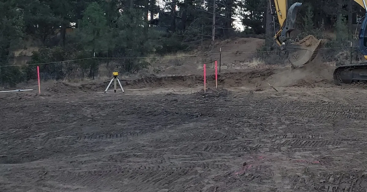
SiteFacts’ advice is to hire a licensed surveyor and have them stake the BFE on site, so you and your customer can see the height. SiteFacts does not complete or certify elevation certificates.
When do I need an elevation certificate?
Your jurisdiction names the points. FEMA’s fact sheet says a community may require a certificate before and after construction.
Section C of the form has three choices for what the elevations are based on. They are construction drawings, a building under construction, or finished construction. If the surveyor checks one of the first two, a new certificate is required when construction is complete.
FEMA says to check finished construction only when two things are done. The furnace, water heater, air conditioner and similar equipment are installed, and the grading is complete.
Federal rules set a floor and do not name the form. They sit in the Code of Federal Regulations (CFR).
Under 44 CFR 60.3(b)(5), a community using BFE data must record the lowest floor elevation of new buildings and substantial improvements. A substantial improvement is work that costs 50 percent or more of a structure’s market value.
In Lane County, Oregon, the code, as amended in 2021, has the administrator obtain a certificate once the lowest floor is placed and before further vertical construction. Where BFE data are used, it also has the administrator obtain an as-built certificate before the final inspection. Both are in Lane Code 16.244, which covers unincorporated Lane County only.
Ada County, Idaho, says its certificate is usually completed at least twice, once from the building plans and once after construction. It will not issue a certificate of occupancy until the final elevation certificate is submitted.
Dunedin, Florida, a Gulf coast city in Pinellas County, requires one at plan submittal. It also requires one at the lowest floor before further vertical construction, and one before final inspection, per its submittal form.
The final certificate is tied to the final inspection or the certificate of occupancy, depending on the jurisdiction.
Where a code asks for a certificate before further vertical construction, a late surveyor can leave a crew idle. Ask the administrator at the permit stage to list every point that needs a certificate, then book the surveyor for each one.
How many surveyor visits should I plan for?
Plan on at least one, and expect more in many places. The number and timing depend on the jurisdiction.
In our experience, plan on at least one surveyor visit to survey the site and set the BFE. Some jurisdictions also send the surveyor back to verify the finished floor and the highest ground next to the walls. Many have a surveyor certify the grade and the finished floor elevation at the end of construction.
Add up the stages above for your jurisdiction. The floodplain administrator can tell you which ones apply.
Plain words for your customer: “The surveyor comes out before we design to set the flood height. The first certificate can be based on the plans. Then we confirm the house sits where the plans said, and again at the end. Your local office decides how many trips that takes.”
What does a surveyor measure for an elevation certificate?
The surveyor measures the floor, the ground around the building, the equipment and any crawlspace vents. Section C requires a field survey.
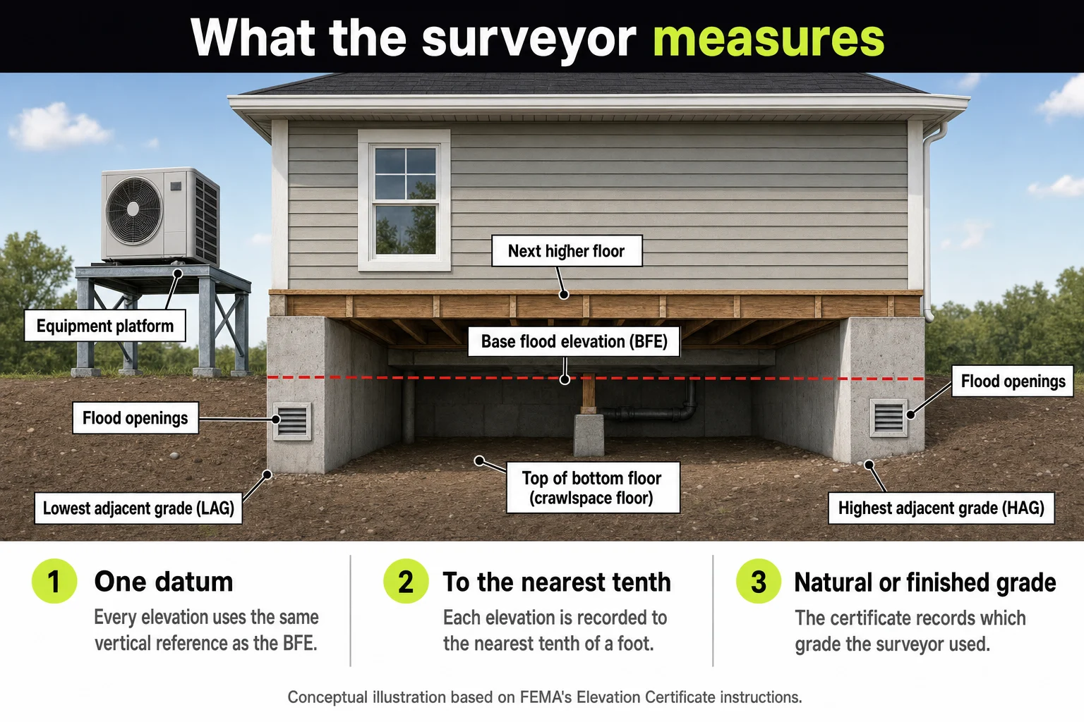
Every elevation uses the same vertical reference as the BFE, called a datum. Each is recorded to the nearest tenth of a foot, per the form instructions.
The main number is the top of the bottom floor, not counting an attached garage. For a crawlspace, the surveyor enters the lowest elevation of the top of the crawlspace floor, whether or not it has flood vents.
It also records the lowest platform or ground under the heating, cooling, plumbing and electrical equipment. A condenser on a low pad shows up. Some jurisdictions set a required height for equipment too, and the hub covers equipment and utilities.
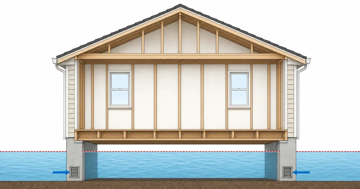
For a crawlspace or enclosure, it records the square footage, the permanent flood openings within 1 foot above grade, and their net open area. Engineered vents need paperwork attached.
FEMA’s Technical Bulletin 1 warns that without clarifying comments, officials and insurance agents may judge an enclosure non-compliant. Part 3 covers how many vents you need.
What are highest and lowest adjacent grade?
Highest adjacent grade, or HAG, is the highest ground next to the walls of the building. Lowest adjacent grade, or LAG, is the lowest.
Natural or finished ground changes the answer. Under 44 CFR 59.1, HAG is the highest natural elevation of the ground before construction next to the proposed walls. Natural grade is the undisturbed ground, before any excavation or fill.
The certificate has Natural and Finished boxes for HAG and LAG. The surveyor records which grade was used. Ask your floodplain administrator which grade your community works from.
HAG is the measuring point where the map gives no BFE. The FIRM, or Flood Insurance Rate Map, is the flood map FEMA publishes for each community.
Zone AO is mapped with a flood depth instead of a BFE. There, 44 CFR 60.3(c)(7) sets the lowest floor above the HAG by at least the FIRM depth.
Zone A has no published BFE. There, FEMA’s Zone A guide says a community may require two or more feet above the HAG. That applies when no other data exists.
The hub covers how the elevation is set on those lots.
What does an elevation certificate cost?
Get quotes from licensed surveyors in your area. The fee is set between you and the surveyor, and FEMA’s fact sheet notes that a licensed professional may provide one for a fee.
Ask each surveyor how many certificates and visits the price covers, and whether it includes staking the BFE and the as-built certificate.
Who pays is a matter for your contract and your quote to the customer. Put the certificates on their own line in that quote, so the cost shows up before the foundation does. For a remodel or substantial improvement on an existing house, ask the floodplain office whether a certificate is already on file.
Does an elevation certificate lower flood insurance?
It can. The NFIP no longer requires a certificate to buy coverage. An owner can still send one to the insurer to see whether it affects the rate.
The jurisdiction may still require it for the permit. Two of its three jobs measure differently: permit approval and insurance pricing.
The jurisdiction compares the lowest floor to the BFE. FEMA’s rating looks at first floor height above the adjacent grade.
In our experience, you can do everything a jurisdiction requires and still pay a top level flood insurance premium. Compliance gets the permit, not the price. Part 4 covers flood insurance on new construction.
A certificate also does not change the map. Only a LOMA or LOMR-F from FEMA can remove the federal flood insurance requirement, and a lender can still require insurance afterward.
A LOMA, or Letter of Map Amendment, applies where the natural ground was already at or above the BFE. A LOMR-F, or Letter of Map Revision based on Fill, rests on permitted fill.
Fill is regulated, so bringing in dirt is not a shortcut out of the zone. Part 5 covers the LOMA and LOMR-F process.
Plain words for your customer: “The certificate proves how high the house sits. It doesn’t change the flood map, and it doesn’t set your insurance price. Get a quote from an insurance agent before you commit, and give them the certificate.”
What a SiteFacts Report does here, and what it doesn’t
A SiteFacts Report flags the mapped flood zone and the overlays that apply to a lot, and it gives you a jurisdiction call list. Each report is analyst verified and typically delivered in 7 to 10 business days.
It does not survey a lot, prepare an elevation certificate or make a flood determination. A surveyor does that work.
Know what applies to the lot before you quote
Order a SiteFacts Report on the lot before you quote. The certificate still comes from a surveyor, and the floodplain administrator decides when you need it.
Terms on this page
- BFE (base flood elevation): the height floodwater reaches in a flood with a 1 percent chance of happening in any year. It is a height, not a depth.
- CFR (Code of Federal Regulations): the set of federal rules, including FEMA’s floodplain rules in 44 CFR.
- EC (elevation certificate): FEMA’s form, signed by a licensed surveyor, engineer or architect, that records how high a building sits compared with the BFE.
- FEMA (Federal Emergency Management Agency): the federal agency that publishes flood maps.
- FIRM (Flood Insurance Rate Map): the flood map FEMA publishes for a community.
- HAG and LAG (highest and lowest adjacent grade): the highest and lowest ground next to the walls of a building.
- LOMA (Letter of Map Amendment): FEMA’s letter removing a lot or building from the high-risk area when the natural ground was already at or above the BFE.
- LOMR-F (Letter of Map Revision based on Fill): the same kind of removal where permitted fill raised the ground.
- NFIP (National Flood Insurance Program): the federal program that sets community floodplain rules and offers flood insurance.
- Substantial improvement: work that costs 50 percent or more of a structure’s market value before the work starts.
- Zone A and Zone AO: high-risk flood zones. Zone A has no published BFE. Zone AO is mapped with a flood depth instead.